
GM8000
Modular multichannel GPR mobile mapping system for the subsurface
 Interchangeable GPR arrays with high speed dynamic range
The highest density of information, accurately mapped in 3D
Virtually limitless data management and computational power
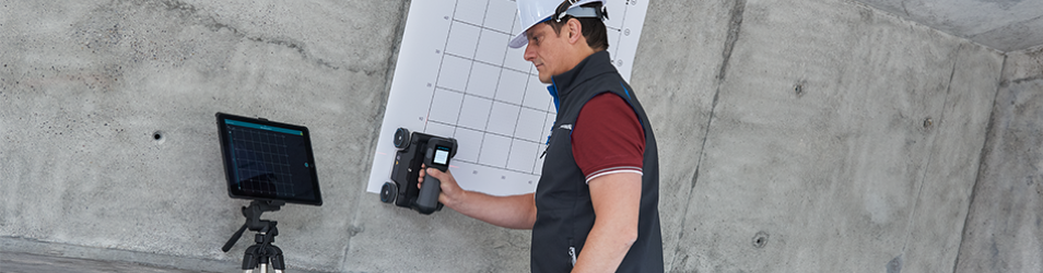
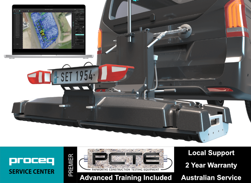
For those who want to take subsurface mapping to a much bigger scale, Screening Eagle released the new GM8000 Mobile Mapping system for the underground.
The GM8000 is a fully equipped GPR system, designed to be towed by a vehicle. The system consists of Multichannel GPR array sensors and an intuitive app to control the whole system during data acquisition. There are two modules, GX1 and GX2, tailored for near-surface - and deep detection, respectively, to have every scenario covered.
This allows the GM8000 to cope with utility mapping, geophysical or archaeological surveys as well as bridge or pavement analysis projects, with nothing else than a simple click-out and a click-in of the corresponding GPR array module.
Applications
- Utility mapping
- Subsurface utility engineering (SUE)
- Surveying & Reality Capture Road inspection
- Bridge inspection
- Airfield investigations
- Structural investigations
- Geophysical investigations
- Archaeology
- Forensics & UXO
- Precision Agriculture
Specifications
| Radar technology | Stepped-frequency GPR | |
| Array Module | GX1 Array x 2 | GX2 Array x 2 |
| Modulated frequency range | 500 – 3000 MHz | 30-750 MHz |
| Number of Channels | 71 (VV) + 31 (HH) | 21 (VV) |
| Channel Spacing | 2.5 cm (VV), 5.5 cm (HH) | 7.5 cm |
| Scan Width | 1.75 m | 1.67 m |
| Scan Rate | 27500 scans/s | 22000 scans/s |
| Time Window | 35 ns | 100 ns |
| Acquisition Speed | Up to 80 km/h | Up to 180 km/h |
| Spatial Interval | Up to 100 scans/m | |
| Power Supply | Power-over-Ethernet or External 12V | |
| Towing system | Rear hitch, 50 mm ball | |
| Shock Absorption | Hydraulic | |
| Dimensions | 414 x 533 x 757 mm + 591 x 630 x 957 mm | |
| Weight | 81 kG | |
| Odometry | Doppler radar or wheel speed sensor | |
| Operating Temperature | -10º to 50ºC | |
| Operating Humidity | < 95 % RH, non-condensing | |
| IP rating | IP65 | |
| Connectivity | USB-C, USB-A, 2x Ethernet + Power, 2x Lemo, 2x ODU Antenna connector, Universal I/O (UART, CAN-Bus) | |
| GNSS Satellites | Multiband GPS + Glonass + Galileo + Beidou | |
| GNSS Real-time Corrections | SSR augmentation or NRTK-compatible | |
| GNSS Real-time 3D Accuracy | Typ. 1-5 cm | |
| GNSS Initialisation | Typ. 5-30 s | |
| Sensor Fusion | GNSS + IMU + Camera imaging + Wheel speed | |
| Feature Tracking | Yes | |